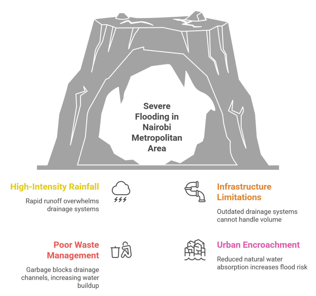
Last week’s rains caused massive flooding after only one week of high-intensity rainfall. This article considers the impact of these floods and the factors that exacerbated flood severity in Nairobi and the surrounding areas (Nairobi Metropolitan).
Effects
The police reported a death toll of 49 across the country nationwide, and more than 2,600 families were displaced. Nairobi bore the brunt of the disaster, with at least 26 deaths. The Central Business District (CBD) also experienced flash flooding that halted vehicle movement for hours. Media outlets broadcast numerous images of the affected roads, including Uhuru Highway, Jogoo Road, Mombasa Road (South C-Kyumbi-), Thika Superhighway (Githurai-Kahawa Sukari), the T-Mall section of Lang’ata Road, Enterprise Road, and Lunga Lunga Road. Also, floodwaters caused displacement, access issues, and property damage in multiple areas, including Pipeline, Embakasi, Mukuru, Kibra, Mathare, Huruma, Baba Dogo, Bosnia, South B and C, Nairobi West, Lang’ata, Umoja 3, Njiru, Roysambu, Kahawa West, Westlands, Githurai, Ruai, and Utawala. The greater metropolitan was also affected. The floods disrupted economic activity and essential services, with traffic congestion and submerged vehicles hindering daily commutes, logistics, and rescue operations. Flooding around Jomo Kenyatta International Airport also caused flight disruptions and diversions.
Contributing Factors
- High-intensity rain marking the onset of the seasonal long rains resulted in rapid runoff, river overflow, and urban inundation.
- Infrastructure limitations contributed to flooding. The city’s storm water drainage systems could not handle the sudden, high-volume rain because they are outdated and poorly maintained. Urban surface runoff during such events clearly exceeds design capacity.
- Poor solid waste management by the residents, garbage collectors, and the county blocked drainage channels. Plastic waste, including bottles and bags, contributed to more rapid water buildup on roadways and inside neighborhoods during the heavy rains.
- Urban encroachment on natural waterways reduced the city’s capacity to absorb or channel water runoff, increasing flood risk in low-lying and informal settlement areas. For instance:
- South C is located on a floodplain where major rivers from the Ngong Hills drain.
- Parts of Lang’ata are adjacent to floodplain and riparian land along the Ngong River.
- Embakasi lies within the Athi River basin region.
These challenges can be addressed using sustainable approaches of infrastructure and urban planning:
- Drainage upgrades (re-design and expand): Climate projections show more frequent and intense storm events, requiring drainage systems that are designed for future rainfall patterns.
- Natural water absorption systems: Wetlands, floodplains, and riparian buffers should be maintained and restored to reduce the quick accumulation of surface water. Land-use regulations should also be enforced to protect natural drainage corridors and prohibit development in high-risk flood zones.
- Waste management: Regular clearing and preventive management of drains, including the removal of plastic waste and other debris, is critical. The city should also consider sustainable waste collection, recycling, and community-level interventions to reduce waste entering waterways during storms.
- Permeable surfaces: Permeable pavements, green spaces, and water-retention features across urban development can reduce runoff during intense rainfall.
- Climate-responsive urban planning: Policy frameworks should integrate climate risks into zoning, infrastructure standards, and city planning processes.
Takeaways
Flooding in Nairobi is not confined to rainfall in the city. Most of the floodwater is storm water runoff from the wider Nairobi metropolitan area, which functions as a shared hydrological system. Interconnected rivers, valleys, and drainage networks convey rapid surface runoff from upstream areas into Nairobi. Urban flooding in Nairobi is therefore a metropolitan-scale issue. Effective risk reduction requires targeted policy actions that simultaneously address land-use and urban planning, storm water infrastructure design limits, and waste management gaps.